Tuxachanie Hiking Trail (West End Trailhead)
Category
Hiking
Typical Duration
20 minutes
Difficulty
Easy
Nearby Experts
Photo Gallery
Tuxachanie Hiking Trail (West End Trailhead) - Tuxachanie Hiking Trail (West End Trailhead)
Tuxachanie Hiking Trail (West End Trailhead) - Tuxachanie Hiking Trail (West End Trailhead)

Tuxachanie Hiking Trail (West End Trailhead) - Tuxachanie Hiking Trail (West End Trailhead)
About This Landmark
Tuxachanie Hiking Trail (West End Trailhead) – Scenic Hiking Near Saucier, Mississippi
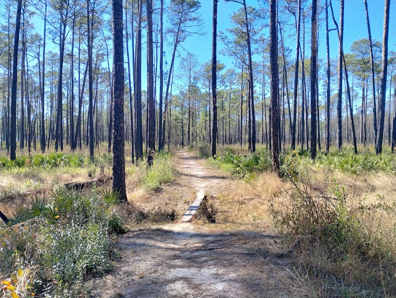
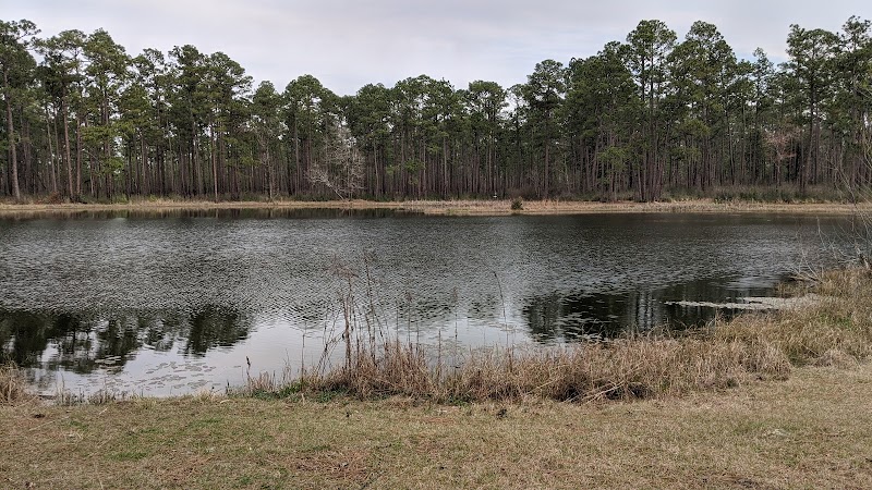
Tuxachanie Hiking Trail, located near Saucier in southern Mississippi, offers a unique outdoor experience within the expansive De Soto National Forest. This trail stands out for its combination of peaceful pine woodlands, diverse ecosystems, and challenging terrain — a welcome contrast to the area's often flat landscapes. Stretching over 11 miles, the trail allows visitors to walk through towering longleaf pines, their needles carpeting the ground and creating a quiet, shaded atmosphere that attracts native wildlife such as white-tailed deer and a variety of bird species.
Hikers following the West End Trailhead will find a route that gently shifts between pine forests and deciduous areas, adding seasonal variety and special opportunities to see wildflowers, fungi, and palmettos. Along the way, small creeks and bayous punctuate the landscape, offering scenic lunch spots and peaceful viewing points. The trail also includes a notable wooden bridge crossing over a creek, a popular turnaround for many visitors seeking a shorter hike.
Historically, parts of the Tuxachanie Trail overlay ancient Native American paths, connecting walkers with the deep human history of the region. While the trail presents sections with roots, exposed clay, and moderate elevation changes, it is well marked and maintained to guide users safely through the natural terrain. There are no facilities like restrooms or picnic tables, reinforcing the rustic appeal of the area.
Tuxachanie Hiking Trail is an excellent destination for those wanting a moderately challenging hike framed by Mississippi’s distinctive forest environment. Its accessibility via a short drive from Saucier makes it an inviting choice for locals and visitors aiming for a natural retreat close to home.
Adventure Guide to Tuxachanie Hiking Trail (West End Trailhead)
1. Hike the Long Pine Forest Trail
- Location: West End Trailhead, De Soto National Forest near Saucier, MS
- Special Features: Over 11 miles winding through longleaf pine forests, shaded and peaceful with diverse terrain including creek crossings and a wooden bridge.
- Local Insights: The mix of pine and deciduous forests offers unique seasonal changes and wildlife spotting opportunities. Early mornings offer cool temps and active birds.
- Visitor Tips: Good hiking shoes recommended due to clay, roots, and uneven footing. Bring water, snacks, and trekking poles if needed. Best timing is spring or fall to avoid summer heat.
2. Wildlife Observation Along the Trail
- Key Features: Frequent sightings of white-tailed deer, various bird species, and vibrant wildflowers enhance the hike. The forest supports a rich ecosystem representative of southern Mississippi.
- Local Insights: Quiet observation helps protect local fauna. Keep dogs leashed to avoid disturbing wildlife.
- Visitor Tips: Binoculars and a nature guide can enrich the experience. Be mindful of no trash bins—pack out all waste to preserve the area’s beauty.
3. Historical Trekking on Native American Paths
- Special Feature: Portions of the trail follow historic Native American routes, offering a cultural connection distinct from typical forest walks.
- Local Insights: Some markers along the trail highlight this heritage, inviting visitors to reflect on the region’s deep history.
- Visitor Tips: A camera is ideal for documenting marker sites. Bring sunscreen and insect repellent during warm seasons.
Practical Information
- Directions: From Saucier, MS, take US 49 north for about 20 minutes to reach the West End Trailhead parking area.
- Parking: Limited spaces, so arrive early on busy days.
- Accessible: Trail is moderate with uneven terrain, not suitable for strollers or wheelchairs.
- Weather: Spring and fall provide mild weather ideal for hiking; avoid rainy days due to potential muddy sections.
Tuxachanie Hiking Trail offers a rewarding outdoor experience combining nature, wildlife, and local history within a manageable distance from Saucier, Mississippi.
- Best Times: Spring and Fall for cooler temperatures and amazing lighting.
- What to Bring: Water, sunscreen, and a camera!
Location
Tuxachanie Hiking Trail (West End Trailhead) in Tuxachanie Hiking Trail (West End Trailhead)
Coordinates: 30.6667, -89.1333
Ratings
Overall
Photography
Reviews
Featured Activities
Primary Activity
Hiking
Also Great For
Essential Information
Nearby City
Saucier, Mississippi
Protected Areas
De Soto National Forest
Experience Level
Experience Needed: This natural landmark is recommended for those with minimal outdoor experience. Perfect for families and beginners.